An official website of the United States government.
 Official websites use .gov
A .gov website belongs to an official government organization in the United States.
Official websites use .gov
A .gov website belongs to an official government organization in the United States.
 Secure .gov websites use HTTPS
A lock or https:// means you’ve safely connected to the .gov website. Share sensitive information only on official, secure websites.
Secure .gov websites use HTTPS
A lock or https:// means you’ve safely connected to the .gov website. Share sensitive information only on official, secure websites.

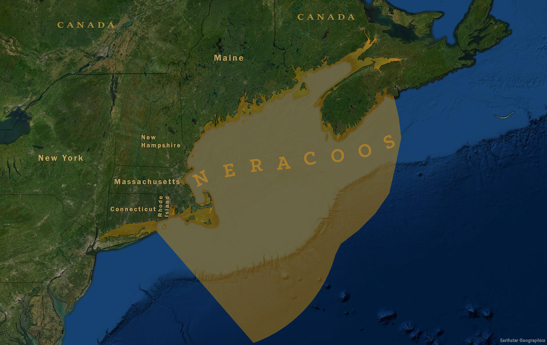
The Northeastern Regional Association of Coastal Ocean Observing Systems (NERACOOS) spans coastal waters from the Long Island Sound through the Gulf of Maine. The Northeast region includes five coastal states, Maine, New Hampshire, Massachusetts, Rhode Island and Connecticut, and the Gulf of Maine, Southern New England Bight, and Long Island Sound. Real-time data to inform operational decisions is the driving purpose of the northeast observing system. Additionally, users seek information to inform decisions as it relates to the safety, economic resilience, coastal preparedness, and ocean life in the Northeastern Region.
Distinguishing characteristics of the northeast region:
- Ensure safe navigation and operations for maritime vessels and the U.S. Coast Guard by providing real-time data on ocean conditions to reduce the risks associated with unpredictable conditions and improve safety.
- Drive success for New England’s fishing and aquaculture industry by delivering information on oceanography, plankton populations, ocean chemistry, and other environmental factors that affect short- and long-term planning.
- Inform event response strategies by delivering reliable ocean data to the National Weather Service and other users. Storm forecasts, coastal flood monitoring, and harmful algal bloom detection better equip people and businesses to respond to natural disasters and mitigate risks.
At a Glance
Executive Director: Jake Kritzer, Ph. D.
For general information, contact info@neracoos.org.
Regional Association Map