 An official website of the United States government.
 Official websites use .gov
A .gov website belongs to an official government organization in the United States.
Official websites use .gov
A .gov website belongs to an official government organization in the United States.
 Secure .gov websites use HTTPS
A lock or https:// means you’ve safely connected to the .gov website. Share sensitive information only on official, secure websites.
Secure .gov websites use HTTPS
A lock or https:// means you’ve safely connected to the .gov website. Share sensitive information only on official, secure websites.
 Regional Coastal Observing Systems (RCOS), previously known as Regional Information Coordination Entities, are non-federal observing organizations who are recognized as meeting federal standards for data gathering and management. In addition, certification requires that the organization operate inclusively, transparently, and seeking user input to determine system priorities. Once certified, their data has the full backing of the U.S. Integrated Ocean Observing System (U.S. IOOS®) and NOAA.
What does that mean? RCOSes operate regional observing networks throughout the U.S., including the Pacific Islands and the Caribbean and have implemented specific practices in regards to data collection, governance, and management. They have submitted rigorous documentation of these practices to the IOOS offices for review and verification. This vetting process is thorough and requires a collaborative relationship between the organization and the IOOS Program staff. Once that documentation is vetted and the organization is recognized as meeting NOAA standards, a Memorandum of Agreement is created, confirming the organization’s elevation to RCOS and certifying that their data can be used with the same quality assurance as federal data.
During the certification application process, the U.S. IOOS program works closely with the organization to ensure that targets and goals are met and documented, and the collaborative nature ensures that the implementation of these targets suits federal requirements while also continuing to support regional and stakeholder needs. Certification lasts 5 years at which point the organization must reapply to be re-certified.
Regional Coastal Observing Systems (RCOS), previously known as Regional Information Coordination Entities, are non-federal observing organizations who are recognized as meeting federal standards for data gathering and management. In addition, certification requires that the organization operate inclusively, transparently, and seeking user input to determine system priorities. Once certified, their data has the full backing of the U.S. Integrated Ocean Observing System (U.S. IOOS®) and NOAA.
What does that mean? RCOSes operate regional observing networks throughout the U.S., including the Pacific Islands and the Caribbean and have implemented specific practices in regards to data collection, governance, and management. They have submitted rigorous documentation of these practices to the IOOS offices for review and verification. This vetting process is thorough and requires a collaborative relationship between the organization and the IOOS Program staff. Once that documentation is vetted and the organization is recognized as meeting NOAA standards, a Memorandum of Agreement is created, confirming the organization’s elevation to RCOS and certifying that their data can be used with the same quality assurance as federal data.
During the certification application process, the U.S. IOOS program works closely with the organization to ensure that targets and goals are met and documented, and the collaborative nature ensures that the implementation of these targets suits federal requirements while also continuing to support regional and stakeholder needs. Certification lasts 5 years at which point the organization must reapply to be re-certified.
- Certification leverages local observing data alongside federal observing data to expand the pool of federal-quality data available nationwide.
- Certification means that this data is as reliable as the data you get from federal sources like NOAA.
- Certification requires that documentation of practices be published, enhancing data and information utility by allowing cross-checking and explaining procedures.
- Certification means that federal sources are able to use this data without spending time and resources on additional QC, and integrate it into their resources and products.
- Certification requires data archiving at a national center which facilitates long-term data research.
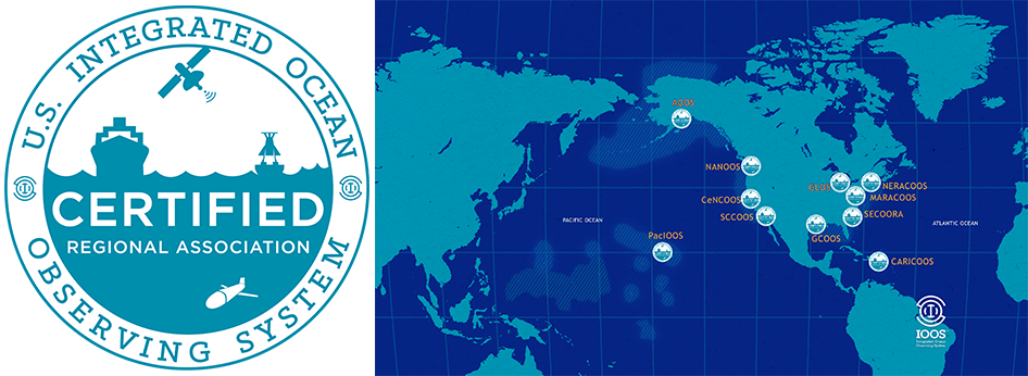
Regional Coastal Observing Systems (RCOS)
- Alaska Ocean Observing System (AOOS)
- Caribbean Coastal and Ocean Observing System (CARICOOS)
- Central and Northern California Ocean Observing System (CeNCOOS)
- Great Lakes Ocean Observing System (GLOS)
- Gulf of Mexico Coastal Ocean Observing System (GCOOS)
- Mid-Atlantic Regional Association Coastal and Ocean Observing System (MARACOOS)
- Northwest Association of Networked Ocean Observing Systems (NANOOS)
- Northeastern Regional Association of Coastal Ocean Observing Systems (NERACOOS)
- Pacific Islands Ocean Observing System (PacIOOS)
- Southern California Coastal Ocean Observing System (SCCOOS)
- Southeast Coastal Ocean Observing Regional Association (SECOORA)