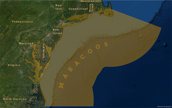

The Mid-Atlantic Coastal Ocean Observing System spans the coastal states from Cape Cod to Cape Hatteras. Coverage includes all of the estuaries and continental shelf waters within that coastal area. MARACOOS seeks to discover and apply new knowledge and understanding of our coastal ocean to help save lives and livelihoods, and maintain the quality of life in the Mid-Atlantic Region.
Distinguishing characteristics of the Mid-Atlantic region:
- Diverse expertise of its approximately 1/3 academic, 1/3 industry, and 1/3 non-profit/government membership.
- Real-time observing and forecasting assets, including high-frequency radar, underwater gliders, weather stations, satellite ground stations, and an ensemble of statistical and dynamical ocean forecast models.
- Connections to a number of data products including the MARACOOS OceansMap, the MARCO portal, and NOAA Co-Ops.
Executive Director: Gerhard Kuska
For general information, contact info@maracoos.org.
Regional Association Map

 Official websites use .gov
A .gov website belongs to an official government organization in the United States.
 Secure .gov websites use HTTPS
A lock or https:// means you’ve safely connected to the .gov website. Share sensitive information only on official, secure websites.
