 An official website of the United States government.
 Official websites use .gov
A .gov website belongs to an official government organization in the United States.
Official websites use .gov
A .gov website belongs to an official government organization in the United States.
 Secure .gov websites use HTTPS
A lock or https:// means you’ve safely connected to the .gov website. Share sensitive information only on official, secure websites.
Secure .gov websites use HTTPS
A lock or https:// means you’ve safely connected to the .gov website. Share sensitive information only on official, secure websites.
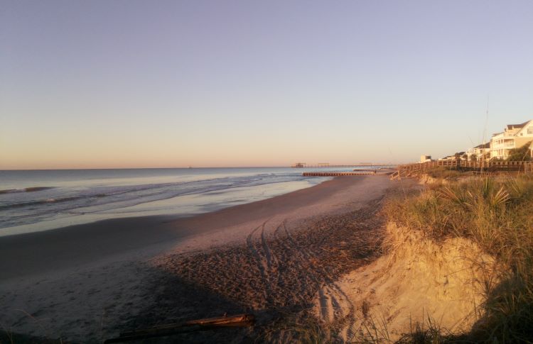
WebCOOS camera view down 6th Avenue Beachfront in Folly Beach, SC. Photo credit: WebCOOS
Over the past five years, the Southeast Coastal Ocean Observing Regional Association (SECOORA) and partners have successfully piloted and are working to transition to operations a coastal webcam network for the Southeast US. The network, known as WebCOOS, streamlines the collection, storage, and access to real-time and historic webcam imagery and enables image analysis and development of derived products that can be used for decision-making. These derived products, developed with open source artificial intelligence machine learning or pixel intensity thresholding algorithms, will show rip current locations, dune overwash, shoreline erosion, beach usage, and flood monitoring — all critical information needs of ocean and coastal managers. This WebCOOS infrastructure will be leveraged to scale up to a national webcam network in partnership with the IOOS Regional Associations to provide a transformational, cost-effective, multi-use observing network.
Funding:
- Year 1: $398,533
- Year 2: $397,463
- Year 3: $399,351
- Total: $1,195,347
Partners:
SECOORA, CARICOOS, CENCOOS, GCOOS, GLOS, MARACOOS, NANOOS, NERACOOS, PacIOOS, SCCOOS, AOOS, University of North Carolina Wilmington, University of California Santa Cruz, University of South Carolina, Axiom, NOAA, USGS, and USACE
News and information:
https://storymaps.arcgis.com/stories/1e3b6fbfab2d4d83971ec040ff168f40
NERACOOS - Maine: https://neracoos.org/projects/maine-webcams/
NERACOOS - Westerly: https://neracoos.org/projects/rhode-island-webcam/
MARACOOS - Cameras of Opportunity: https://maracoos.org/2025/03/20/webcoos-expands-in-midatlantic/
Fahim Hasan Khan, Akila de Silva, Ashleigh Palinkas, Gregory Dusek, James Davis, and Alex Pang, ``RipFinder: Real time Rip Current Detection on Mobile Devices'', Frontiers in Marine Science, May 19 2025, Sec. Ocean Observation, Volume 12 - 2025, doi: doi.org/10.3389/fmars.2025.
Fahim Hasan Khan, Donald Stewart, Akila de Silva, Ashleigh Palinkas, Gregory Dusek, James Davis, and Alex Pang, ``RipScout: Realtime ML-Assisted Rip Current Detection and Automated Data Collection using UAVs'', IEEE Journal of Selected Topics in Applied Earth Observations and Remote Sensing, volume 18, pages 7742-7755, 2025. doi:
10.1109/JSTARS.2025.3543695